Around Annapurna
One of the most interesting and massive travel routes in the Himalayas is the ring around Annapurna (or Anapurna) - a mountain range with a peak over eight thousand meters high. It is quite possible to organize and conduct this trip on your own. The optimal time is either April-May or September-October.
In order to travel in Nepal, the main condition is to take a plane ticket to Kathmandu and back. An analysis of all options showed that the best offer is given by Qatari Airlines: 3 months before departure, we took tickets from Moscow for 26.100 rubles round trip.
About 7 hours we traveled by bus from Kathmandu to the village of Dumre. Next, I had to move on my own. In Dumra, for 3.500 rupees ($ 50), a jeep was chartered, which drove us and 2 more Englishmen through the town of Beshisahar to the village. Kudi, where the road ends and the hiking trail begins. We found a guesthouse (“hotel”), where for 100 rupees ($ 1.5) we rented rooms for two. We had dinner there and ordered breakfast for the morning.
So we got to the trail. The further route by day was as follows: Kudi (790 m) - Bahundanda (1200 m) - Chamche (1410 m) - Bagarchap (2080 m) - Chame (2500 m) - Pisang (3000 m) - Manang (3530 m) - Dnevka - Leder (4200 m) - Torung Pedi Upper Camp (4900 m) - trans. Thorung La (5416 m) - Muktanah (3760 m) - Jomson (2700 m). Heights of settlements or objects are indicated in brackets. All crossings take 5-6 hours. Crossing is about 8-10 hours.
From Jomson to Pokhara you can get by plane in 20 minutes or go down on foot in 4 days, although there is also a 3700 m high “passage” along the way. There is also an airfield on the other side of the Thorung La pass between Pisang and Manang, where you can fly in or fly out of Pokhara back in the event of an emergency exit from the route. The cost of flights is about $70. In the airfield area there are military units and check-points where permits are checked.
Along the way, there are other villages, and detached guesthouses every 2-3 km, where you can spend the night. Each guesthouse has a restaurant with an extensive menu on several pages. It is advisable to have a pocket English-Russian dictionary with you in order to understand what is offered and how to order just soup or soup with noodles, vegetables, eggs, mushrooms, chicken or something else. There is also a large selection of second courses, as well as tea: black, green, Tibetan, with milk, and alcoholic beverages (Kukururama (Nepalese rum) or local moonshine, which happens in autumn, is recommended).
For some reason, all the inhabitants of the mountains love spicy food. If you eat local dishes in the usual way, then after the first spoon you feel that a fire is burning in your mouth. Therefore, when ordering dishes, it is better to immediately say: “No chily”, i. e. no need for pepper.
In the villages, as a rule, there is a satellite phone, which is very difficult to get through to anywhere, because. All telephones in the village are connected to one dish. This requires patience and luck.
Before the trip, we read a lot about the problems in Nepal with drinking water and the recommendations to use only factory-packed bottled water for drinking. However, the same recommendations are given for vacationers in Turkey and Egypt. Water in a liter plastic bottle in Kathmandu costs 20 rupees, on the route 50-100 rupees, and in a guesthouse before the pass its price reaches 150 rupees. Naturally, it is a pity to pay such money for plain water. Therefore, we often used water from concrete columns, which are now available in almost every village. We believed that if a concrete column was made, then the water intake should be reliable. Indeed, later we learned that 2-3 years ago, under the UN program, the problem of providing drinking water to the mountain villages of Nepal was largely resolved. However, you should not drink water from a clean-looking stream, as we used to do in the Caucasus, if there is or may be a village upstream.
Our first walking day was difficult: adaptation to the tropics, very hot, stuffy. L. N. having experienced, apparently, a heat stroke, she barely made it to the overnight stay. Other young ladies in the evening did not look very good either. In the future, they went only from 6 am to 12 pm. If they didn’t have time to reach the place, they stopped at some guesthouse and rested until 4 pm, and then they caught up with the schedule.
We hired 2 Sherpas ($10 per day each), who carried heavier men's backpacks (20-24 kg), men carried women's (10-12 kg), and symbolic women (with handkerchiefs and powder - 1-3 kg. ). The Sherpas turned out to be very smart: one of them spoke good English, suggested the traffic schedule, the best places to stop, the choice of dishes in the restaurant, etc. Sherpas, who are called porters here, can be hired in any village, just contact the owner of the guesthouse. There are many young people here who do not have a permanent job, and everyone is happy to receive a solid income, at least for the next 10-15 days. Porters are unpretentious, they spend the night in the same guesthouses in a warm utility room side by side on the floor, where mattresses are laid out at night. They eat here and apparently with a good discount for bringing the owner of the guests or smiling at the local beauty.
After acclimatization, starting from the 4th day, it became easier to move, we walked with pleasure, and we had time to make the transitions before lunch.
The trail goes along the river all the time, constantly gaining 100 meters up, and then losing more than half, and often changing the bank. Crossings across the river are provided with the help of new metal suspension bridges.
As we climb, nature changes. At first we see stepped slopes, where something grows on every patch, small villages perched so high that it’s scary to look at them, bamboo thickets, ficus trees and Nepalese with a slingshot shooting back from wild monkeys attacking crops.
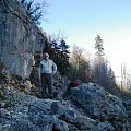
Then the trail passes along the slopes of a deep canyon, along the sides of which picturesque multi-cascade waterfalls rush down. No peaks are visible, only steep overhanging cliffs. Sometimes the trail is carved directly into the rock. In places of landslides, walls supporting the path were built. There are no fences, despite the abysses deep for hundreds of meters nearby. The width of the trail is about one and a half meters so that oncoming caravans of loaded donkeys can disperse in any of its places. Donkeys are the main means of transport for hundreds of kilometers of densely populated gorge. In Nepal, left-hand traffic and donkeys are trained to diverge from oncoming people on the left side without breaking the formation. What bewilderment is written in their eyes when an oncoming tourist, clinging to the slope away from the abyss, takes the wrong side on a narrow path. What kind of a donkey are you if you don't know the rules, apparently they think.
On the trail, in addition to caravans of donkeys, there are also Sherpa porters with oversized cargo (roofing iron, cages with poultry, satellite dishes, etc. ). There are groups of trackers (hikers) from all over the world: Germans, Italians, British, Poles, Ukrainians, Canadians, Japanese, Chinese, Israelis, Australians, New Zealanders and others. They go in groups, together, alone. You can get acquainted with them right away, because. then you will meet more than once, and you will go to the pass almost in formation. Feel free to say "hai", "moning" or "sholom" and try to ask some stupid question in English, like: "Haw many days you wont to go around Anapurna? " in response you can get in good Russian: "15-18 days. "
In the area of Tull village, the valley widens and the trail for more than a kilometer goes along the bank of the calmly flowing river Marsyangdi. From above, the Himalayan rivers look like small streams on the bed of a wide rocky floodplain, reflecting the true width of the river during the rainy season.
After the village of Bagarchap at an altitude of more than 2300 m, the valley widens again, the trail turns into a road passing through a pine forest. Now you can see the snow-capped peaks. Sometimes, with your head up, you admire the mountain, leaving in the clouds, and admire its height. Suddenly, the wind blows away the cover of clouds from it and opens another kilometer of the peak, stretching into the blue heights. Fantastic, possible only in the Himalayas.
After the village of Chame, moving up, we had the pleasure of admiring the gradually opening peaks: Annapurna 2 (7937m), Annapurna 4 (7525m) and Annapurna 3 (7555m). Only the eight-thousander Annapurna 1 (8091m) was hidden from view behind other peaks. However, we saw other giants of the Himalayas - Manaslu (8156 m) and Jaulagiri (8167 m).
In the upper part of the valley there are many attributes of Buddhism: monasteries and temples, guarded by one novice, which can be viewed; stupas decorated with flags and placed in the mountains at any available site; strings of drums that adorn each village, which must be rotated with the right hand so that everything that is destined for you by the Almighty is fulfilled.
In the village of Manang, before a two-kilometer pass take-off, they usually make a day trip. In the center of the village, near the road, there is a diagram of a dozen radial acclimatization routes, lasting from 20 minutes to 6 hours with visits to alpine lakes, ancient monasteries and viewpoints, which are useful to make in order to feel better when storming the pass.
Starting from 3000 m, in the morning we saw frost on wooden railings, tables, benches. Above 3500 the vegetation becomes sparse and ends soon. Starting from 4000 m, the height is felt, it became more difficult to climb. After 4500 m you have to stop to rest every 30-50 steps. Spending the night at an altitude of 4900 m is remembered as a complete nightmare: ragged sleep, heavy breathing, thirst, fantastic dreams, mental retardation and reaction: any action - put on shoes, fold a backpack - looks like an insoluble problem.
It takes 4-5 hours to walk through the snow to the pass, and interestingly, on the saddle at an altitude of 5416 m there is also a guesthouse where you can at least drink hot tea for 300 rupees a liter. If you can’t bear to go to the pass, but you don’t want to retreat, then you can hire a horse with a guide at the last stop, which will take you to the saddle in 2 hours. True, they ask for $ 70 for this pleasure. They say that in the lower villages you can hire a horse for the entire route to the pass for $10 a day, that is, at the price of a porter.
Descending from the pass is naturally more fun. With each step, it is easier to breathe, the legs go faster, and after 3 hours you can slowly reach the village of Muktanakh, and the next day to the village. Jomson, where there is an airfield. From Jomson (2700 m) we fly to Pokhara by plane. In a 20-minute flight, we saw the Himalayas from above: valleys with frequent settlements, fields on stepped slopes, rivers raging below and snow-white giants nearby. Tickets were taken in advance, although this could not have been done. The authorities themselves make sure that tourists do not accumulate in the mountains and, if necessary, send additional flights of a 15-seat aircraft.


