Walks in Altai (continued)


Small digression:
The Altai Mountains are a mountain system in Asia, in southern Siberia and Central Asia, consisting of high and mid-mountain ranges separated by deep Valleys rivers and extensive intramountain and intermountain basins. It extends from the northwest to the southeast for more than 2000 km.
The mountain system is located on the border of Russia (Altai Krai and Republic of Altai), Mongolia (Bayan-Ulgi and Khovd aimag), China (Xinjiang Uygur Autonomous Region) and Kazakhstan (East Kazakhstan Region).
Altaic, Katunsky reserves and plateau Ukok collectively form an object D0%BE%D0%B5_%D0%BD%D0%B0%D1%81%D0%BB%D0%B5%D0%B4%D0%B8%D0%B5">World Heritage UNESCO «Golden Mountains of Altai". (Wikipedia).
Srostki is a village in the Altai Territory, the birthplace of Vasily Shukshin, he photographed these regions with special tenderness.
I really love the film "Such a guy lives", it was filmed on the Chuysky tract, or rather, the Chuysky tract was filmed in the film, and now I always try to compare the frames from the film and the places we pass through.
Srostki are also good for their bazaar, where they sell homemade pies with a wide variety of fillings, and pies are not very small! There are also cool potato pancakes - stuffing of minced meat with onions, and a shell of grated potatoes, everything is so fried and tasty! The beauty is that the bazaar is always there, even late at night, and the village is located at such a distance from the end points of the route that you, having left the house, are already ready to refresh yourself, or, having traveled a capital number of kilometers, you feel that it would be nice to refresh yourself, because sawing home for another five or six hours.
Kumir River.
1. From someone we heard the wonderful words “Maiden stretches on the Kumir River” and began to want to go there. I have long stocked up with a wonderful book-guide to Altai, but I did not find these words there. My husband went through the Internet and found some notes, so old that distances were measured in them in versts (! ), nothing, counted in kilometers and went to Plyosy for the first time, there were five days of vacation left, the beginning of June, the weather was not bad, should have been warm enough. Three hefty men fit in our car - the father of the family, son and our wonderful friend Lyokha - and me and my thirteen-year-old niece, plus the corresponding number of clothes. (It was a cool car, I need to shut up, otherwise I will only write about it).
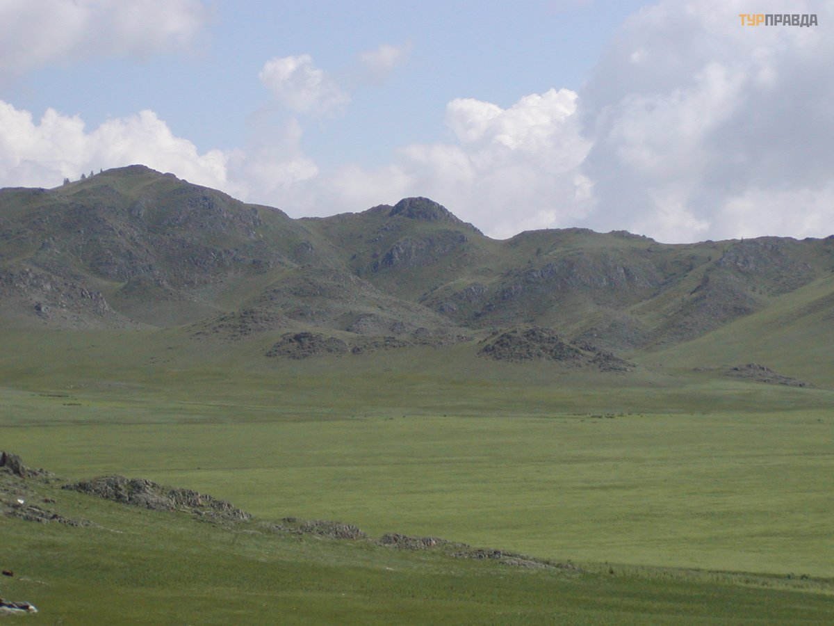
In those days, it seemed to us that if you leave at three o'clock in the morning, you have time to skip most of the way near large settlements on a more or less free road, the M52 is two-lane mostly, there are fewer problems with overtaking. After driving six hundred kilometers, near Tuekta we turned right onto the gravel road and moved west towards Ust-Kan. The landscape is steppe-yes-steppe-circle with small peas on the horizon.
It was getting dark, the road was getting worse, it was time to slow down for the night.
If you don't have to look at the map, you see, they wouldn't freeze at night! We stopped near the Yabogansky pass, which we found out only in the morning, a hundred meters did not reach the sign.
And the pass is not serious, some one and a half kilometers above sea level, who will notice it against the background of one thousand two hundred and one thousand three hundred meters, on which that steppe is located! For me then it was a discovery that it is always cold on the passes, even in July, and cedar firewood burns, but does not warm, I almost put my hands into the fire. But the morning came, the sun warmed us, and we drove on.
Special entertainment was to watch gophers in the steppe. These scoundrels strove to sit on the side of the road, waiting for the car to drive closer, and then cross the road here. The couple even played “Russian roulette” - they chased one after the other along the road, we waited in horror to see who would push someone under the wheels, slowing down, of course. We decided to stop to take a breath and take pictures of the animals, all the more, it seemed that the whole steppe was moving - gophers now and then, from different sides, protruded from their minks. Yes, pests, but there are no arable fields there, and they are also pretty, and they have plenty of enemies with wings. We got out of the car - not a single muzzle protrudes, only at a distance. They tried to lure them out for a cookie near the mink itself - it doesn’t work! They spat, climbed into the car; as soon as the engine purred, the animals crawled out!
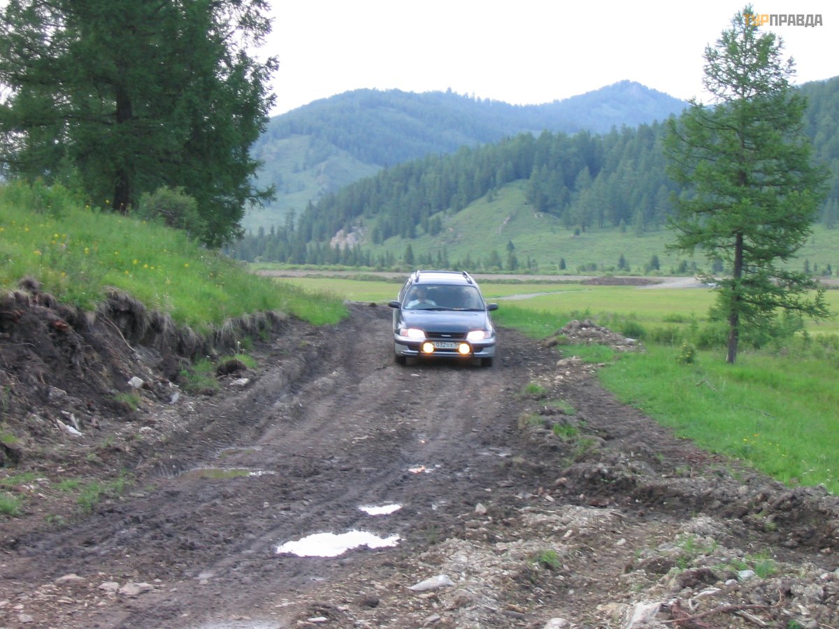
We passed the district center Ust-Kan, thirty kilometers further along the Charysh River, and here it is, the bridge over the Kumir. Without crossing the bridge, we turn left, and instead of the road there is a hodgepodge of stones and puddles, although there has been no rain for several days. Worst of all, the stones were very well hidden in the puddles. In order to increase the clearance of the car, and we ourselves got tired of sitting in cramped conditions for so long (on the way we grabbed a chock lying on the road - who knows what the situation with firewood is! As a result, the second row sat with his knees pressed to his chins), went on foot, leaving the driver alone to taxi through this outrage, without our advice.
How beautiful it was around! The road then dived to the river, then climbed another rock, and the river was transparent, quite full-flowing, small waterfalls rustled into it, and we were afraid of one thing that we would not recognize the desired Maiden's reaches, well, we had no idea what "stretches" were, we guessed, what should be beautiful.
Recalculation from the number of miles gave seven kilometers, that is, stomp and stomp over rough terrain, those in the car show kilometers on the speedometer.
After half an hour of travel, they discovered the reason why there was not a word about those Plyosi in my book - the remains of a chain-link fence dangled from both sides of the road, no inscriptions, even the most rusty ones. They looked for an answer in a map published, albeit in the current century, but the data there were, in my opinion, from the mid-nineties. It turns out that we crossed the border, the territory of the Altai Territory began behind the fence, and the guide pedantically reported only about the sights of the Altai Mountains, vermin!
Climbing the next rise, we realized that we had come - there was a minibus on a small platform surrounded by trees, and several people looked with delight from the cliff into the water. The spectacle was fascinating: in a narrow gorge, the water accelerated with a roar, and after ten meters it spilled into a deep and wide stone bowl, the transparency of the water was broken only by quiet trickles with bubbles. A "ladder" made of stones and tree roots descended from the platform to the water. I wanted to immediately plunge into it, not paying attention to the temperature of the water!
A fire pit was organized on the site, a table with benches, well, such a semblance of improvised materials, we decided to stake out a parking lot. It turned out a little later that the place, in fact, was not very successful, there were more clearings further on, which were a little more difficult to drive into, and it was a little further to go down to the luxurious water, but the cheerful rafters, who, a kilometer upstream, jumped into water, with whooping and whistling flew on inflatable rafts along the "throat" of the gorge, then got out of the water in the "bowl" of still water, and so with a frequency of once every half an hour, they will not stomp the crowd with a raft on your head around your camp.
In addition, the Kumir River flows through the gorge, from south to north, when you put up a tent near the Plyosy, you have a tall mountain behind you, and in the morning you have to wait quite a long time, sometimes chattering your teeth from the cold, when the sun finally comes out from behind its top, it will start to warm you too. And opposite the rocks are already flooded with warmth and light.
We were delighted by the guys who came from Ust-Kan, very politely asked permission to look into the water from the cliff, looked, turned around and left. We wondered what they looked like? It turned out they were interested in a possible catch. The transparency of the water is such that the presence or absence of fish can be seen immediately. But grayling is found there, on one of the following trips we saw a flock ourselves.
By the way, there were firewood, falling larches, the heat capacity is so-so, but while you are sawing, you are warming yourself. At that time, I managed to awkwardly swing an ax and hit my leg, poured it with “pro-ambassador” - a chic propolis-based remedy, a spray originally created against a cold - you splash it in your throat, your eyes jump to your forehead, sparks pour out of them, and the poor organism says : "Nafig! We’d better not get sick, we can’t stand such treatment! ”, But for wounds, the very thing is, the hair also stands on end, but the cooling effect becomes analgesic and hemostatic. And disinfectant. For several days I walked with my leg wrapped, and my loving husband held me by it when I climbed into the water so that the bandage would not get wet (fortunately, there were no photographs of this stupid spectacle). No leg could stop me, I had to take a walk along the river, and it’s simply impossible to walk nearby and not climb into this water.
There are valleys upstream, the sun comes there much earlier, but there is not always a convenient descent to the water, and the river is rather shallow in these places, you can swim using the “partial immersion” method.
On that trip from Kumir, we were returning through Black Anui, we wanted to take a closer look at the Denisova Cave (traces of different eras of human development were found there, a kind of “layer cake”, about twenty layers). We didn’t come across any guides, and we didn’t want to go down into the dark coolness with a sun-drenched surface - we are not speleologists at heart! But in the vicinity of the Cave there are camp sites from which vacationers are taken to Kumir on excursions.
(To be continued)


